Catalog
- Results include
-
-
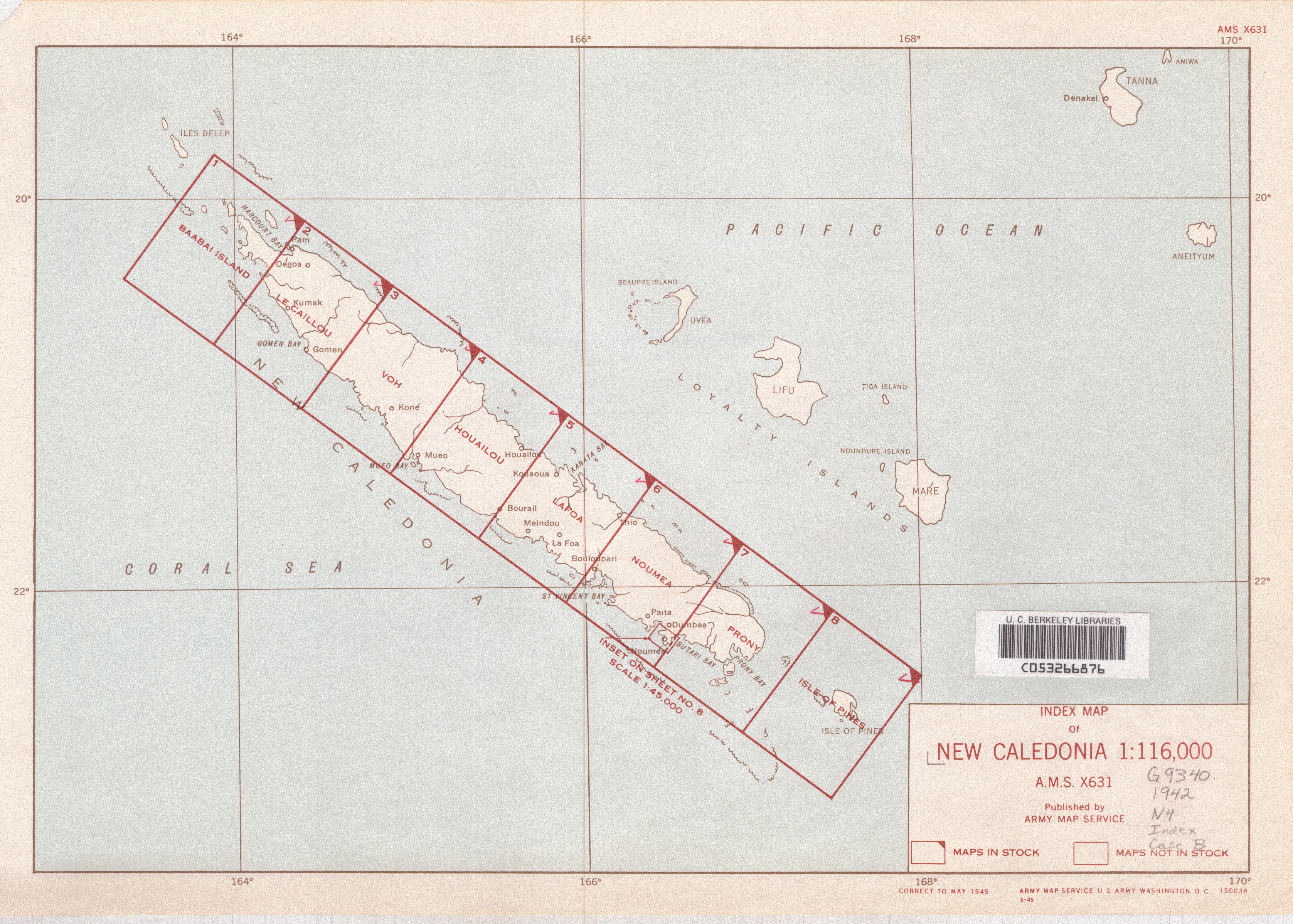
New Caledonia
Logan, Leanne, 1964-3rd ed. - Hawthorn, Vic., Australia ; Oakland, CA : Lonely Planet, c1997.Thoroughly updated, this guide includes cultural and historical background, a useful language section, as well as information on all the best places to stay and eat for a range of budgets.
-
Your search also found 1 topic specific databases.
Guides
Library website
Exhibits
EarthWorks
-
New Caledonia
United States Department of State. Division of Geography and Cartography1944Legend includes mining and mineral deposit information, seaplane anchores, air bases, roads, railroads. Inset map showing air line distances in sta...
-
Boundary, New Caledonia, 2015
Hijmans, Robert J. and University of California, Berkeley. Museum of Vertebrate Zoology2015This polygon shapefile contains the boundary of New Caledonia (adm0). This layer is part of the Global Administrative Areas 2015 (v2.8) dataset. Hi...
-
Commune Boundaries: New Caledonia, 2010
Articque informatique2010This polygon shapefile represents the Commune Boundaries of New Caledonia for 2010. These are the level 5 administrative divisions (ADM5). French c...

More search tools
Tools to help you discover resources at Stanford and beyond.