
The banner image above shows STSS-1 and two unidentified spacecraft over Carson City, which depicts several concentric circles of various thickness on the left. The image on the right shows a detailed, informative pictorial lunar chart and map of the world that depicts the flight of the GOSS mission to the moon.
Stanford, CA—The David Rumsey Map Center at Stanford Libraries for the first time will borrow art from artists and institutions around the country, pairing their pieces with cartographic material from its collection for Coordinates: Maps and Art Exploring Shared Terrain. The exhibition features a variety of ways in which the two mediums overlap in inquiries about space, both geographical and metaphorical. The exhibition opens on Thursday, April 25, 2019 with a daylong symposium and reception.
“The crux of this exhibition is to provide visitors with an opportunity to ponder new questions and ideas about both the map and the art piece and to liberate pre-conceived notions about what either is or is not,” said G. Salim Mohammed, head and curator of the David Rumsey Map Center.
The exhibition was conceived and curated by David Rumsey, founder and namesake of the map center at Stanford and Emily Prince, cartographic metadata librarian at Stanford. Rumsey, who received a Master of Fine Arts from Yale University, always envisioned the David Rumsey Map Center as an interdisciplinary ‘geolab’ where maps offer scholars, from any discipline, a new lens for investigation and inquiry. Since its opening in 2016, the Rumsey Map Center has welcomed several classes spanning disciplines in art, civil engineering, classics, earth sciences, among many others.
In a written introduction for the exhibit catalog Rumsey and Prince describe their desire for combining the two formats, “Art holds our attention in looking and makes us conscious of our focus. Maps pull us deep into a three-dimensional space that is laid before us in two dimensions. Both force us to observe ourselves in the act of seeing—examining not only what we see, but how and why. Viewed together, they take us by surprise.”
Coordinates is curated in a way that brings together two seemingly different objects, but when collocated the efforts of the mapmaker and artist to convey location, perspective and imagination begin to look more similar than different. As Rumsey and Prince note in their essay, “Both rely on visual symbols and their codes of association to convey meaning. Both play with scale. Neither represent terrain literally, stripped of all symbology, or in a one-to-one scale. A map is not so much a visualized topography as an interpretive guide to it; just as an artwork is not an illustration but an investigation of how to look with an eye that widens from the concrete to envision an abstract concept. As an aesthetic gesture, a map is inherently an art: tracing, interlacing, erasing. As a document of interpretation, art becomes a map of meaning.”
Rumsey and Prince partnered with curator and writer Jordan Stein to produce a catalog for the exhibition. Stein explains his role in the development of the catalog was more akin to a correspondent, ‘tracing the contours of Rumsey and Prince’s work and conveying it in writing.
“…My aim is somewhat similar to theirs: to unsettle the ground between the perceived objectivity of maps and subjectivity of art; to loosen—even if slightly—our grip on knowing; and to take a closer look at what terra incognita might mean in the context of their efforts,” wrote Stein in the catalog.
Coordinates: Maps and Art Exploring Shared Terrain will be on display from April 25 thru September 31, 2019 in the David Rumsey Map Center at the Cecil H. Green Library on the Stanford campus.
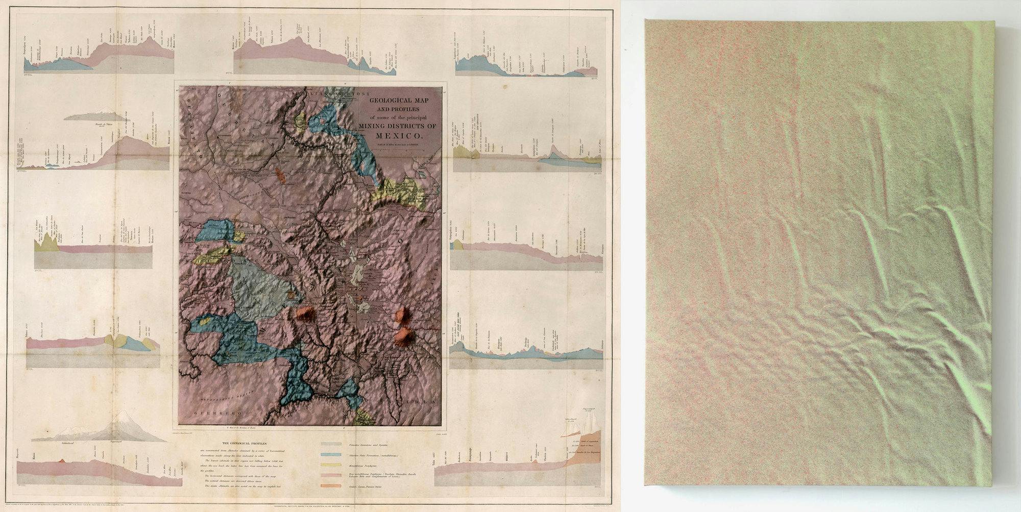
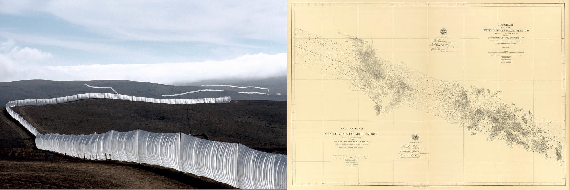
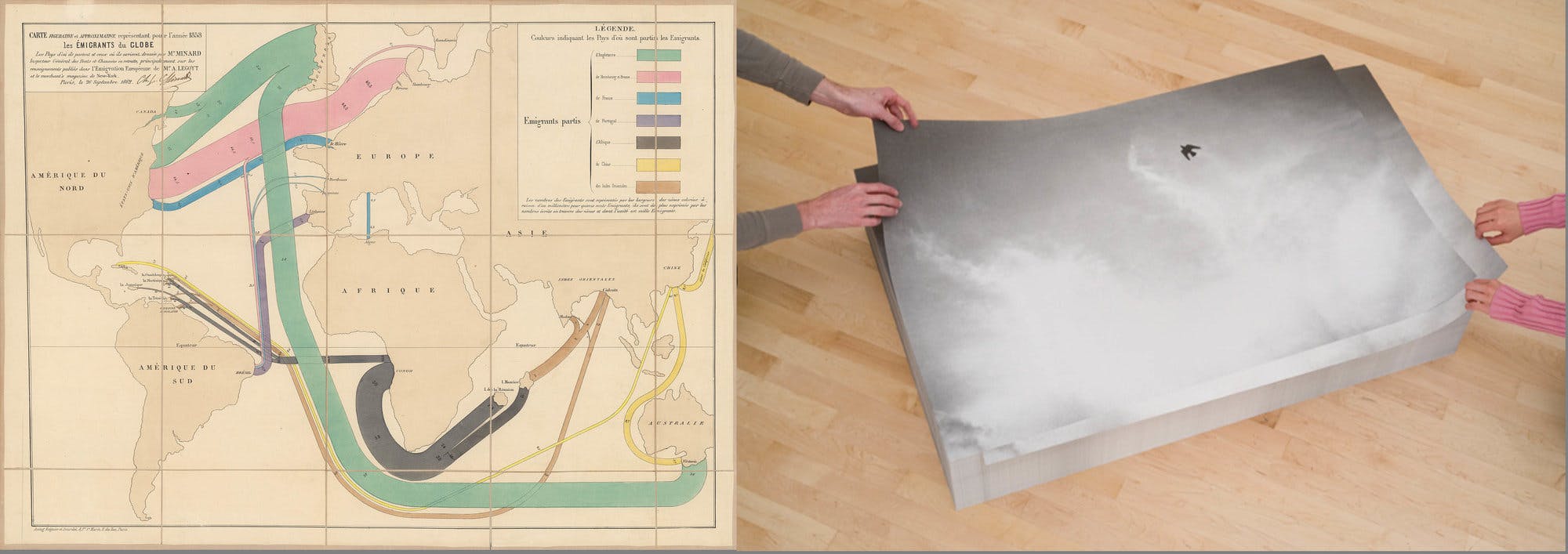
Artists included in the exhibition are Zoe Leonard, Trevor Paglen, Tauba Auerbach, On Kawara, Sol LeWitt, Richard Long, Felix Gonzalez-Torres, Agnes Denes, John Pfahl, Ed Ruscha, Christo and Jeanne-Claude. In dialogue with the art, will be maps by pioneering cartographers, such as J. C. Fremont, R. Buckminster Fuller, Richard Saul Wurman, Zero per Zero, Charles Joseph Minard, Joseph Salway, F. W. von Egloffstein, J. A. Martignoni, Isaac Frost, Sir David Brewster, and Stanford’s own Dr. Rob Dunbar.
In one instance, the art is meant to be taken. A stack piece known as Untitled 1992/1993 by Felix Gonzalez-Torres (pictured below on the right), will be placed one on top of another in a stack, welcoming interaction with the art and inviting visitors to take a piece and reinterpret the piece in their own environments. "We are honored to collaborate with both The Felix Gonzalez-Torres Foundation and SFMOMA in order to bring this work into the library. This partnership is a beautiful example of our ethos as librarians - sharing," said Prince.
The opening day symposium will include talks by SFMOMA Librarian David Senior; Director of the Felix Gonzalez-Torres Foundation Emilie Keldie; writer Abby Smith Rumsey; art historian Emanuele Lugli; Director of the Holt-Smithson Foundation Lisa Le Feuvre; geographer Joshua Jelly-Schapiro from the New York University Institute for Public Knowledge; Jordan Stein from KADIST, San Francisco; and mapmaker David Medeiros. The symposium is free and requires advanced registration.
The David Rumsey Map Center is open to the public from 1:00p.m. to 5:00p.m. Monday thru Friday; entrance is free but requires registration. When planning your trip to the Rumsey Map Center, please check the David Rumsey Map Center's webpage as there are occasions when the Center is closed due to class use.